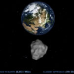
The easiest way to show the continents on earth is on a round globe, after all the earth is round. But there are times when we must use a map instead. Many of us may not realize that a flat map is not the best representation of the relationship of continents and their sizes. In order to get understand why, we will learn How to Make a Globe Flat and why we would!
Distortion! There is just no way to take that round globe and make it flat without deforming and transforming some of the sizes and relationships of the continents. One of the most common ways I’ve seen to demonstrate this distortion and how you can’t take a round earth and make it flat without have distortion is by using an orange peel. Another way that I found to be very effective in this demonstration is using a balloon
To turn a spherical surface into a rectangle or other two-dimensional shape, we have to transform it or deform it by stretching it and/or compressing it. To see what happens when you deform a spherical surface, use a balloon. First blow up the balloon and tie it off. then draw rough outlines of the continents on the surface. Carefully cut off the tied end of the balloon and snip through the Pacific Ocean. Now try to flatten it into a useful shape. What does it look like? What happens to the shapes, sizes, and positions of the continents?
Cartographers have better ways to project spherical surfaces onto maps than stretching them by hand, but they’re subject to the same limitations. All projections deform the earth’s surface in some way, which means that every projection is in some way inaccurate. The trick in drawing or selecting a map is to find the projection that shows key information for a given region with the least inaccuracy.
The Mercator projection map commonly used on globes was developed in 1569 by a Flemish cartographer to aid navigators on their voyages. Unfortunately, it shows land masses Greenland and Antarctica much larger than they actually are. John Paul Goode. He was very concerned about how the Mercator Projection map distorted the land mass sizes and thought it would confuse students. So he set out to create a better map than the Mercator projection map. At the 1908 meeting of the Association of American Geographers, Goode described the Mercator Projection as “evil.” It is for this reason he set out to create the Goode Interrupted Projection map.


Let's discuss.... comment and share your thoughts!